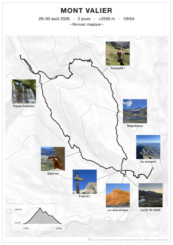
Digital file
Your poster in high definition, JPEG and PDF, to print wherever you like or to share.
Import your GPS track
Important: direct connection to Strava is awaiting approval from Strava. Please upload your file manually (guide).
Panoralia reads your activities to build a track from them. Nothing is posted to your account, and the connection closes with your browser.

Does one file contain several activities? Split it first, for example on gpx.studio, then load one file per activity.
Without a track, the poster is built from your photos: at least one must be geotagged.
Select your best memories
Only add photos you hold the rights to use. Learn more
Orientation, style and photo layout
Previews: © IGN-F / Géoportail · © OpenStreetMap contributors
Note: part or all of your poster will probably be outside France. The IGN map may not be the best choice.
A3 at 300 DPI, printable in A3 or A4.
None in this layout: the photos take their place.
Photos are placed from their GPS position or the time they were taken. If one of them is in the wrong place on the poster, turn this option on: a slider appears in its card. Turning it off puts every photo back in its original position.
Check your poster before ordering.
The file is available right away. Prints are coming soon.
Choose the size.
Shipping included, delivery to the 27 countries of the European Union (excluding overseas territories). No delivery yet to the United Kingdom, Switzerland, Norway or outside Europe.
The poster shown on screen is the file sent to print. The paper poster will be trimmed slightly at the edges for a cleaner finish.
Required for a digital file delivered immediately (article L221-28 13° of the French Consumer Code). A printed poster, being personalised, is excluded by law and does not need this box.
Unless you tick this box, we may write to you about your posters and our offers, with an unsubscribe link in every email.
Noted. To follow our news without emails, find us on Instagram.
It is paid and unlocked. Download your files before closing the page.
Your poster is also kept online until , at this retrieval link, also sent by email. After that date, it is deleted.
Share your adventure
Post your poster on Instagram or Facebook, tagging @panoralia or with #panoralia. We love discovering your trips, and with your permission, the finest will be featured on our account.
The preview is in reduced quality, the final render will be in HD, as the magnifier shows.
Design your poster with your tracks and photos, change the style, start over as often as you like. You choose what to order at the end.
Your poster in high definition, JPEG and PDF, to print wherever you like or to share.
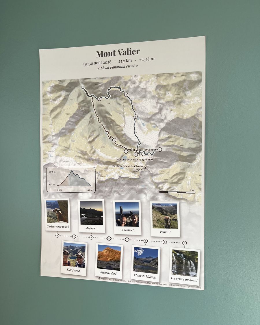
Printed in Europe on thick 200 g semi-gloss paper, delivered to your door. The HD file is included.
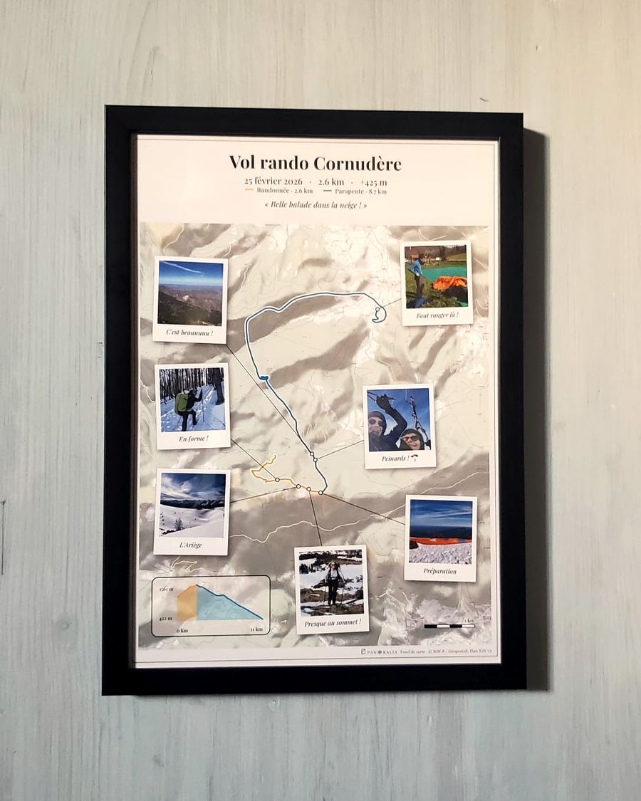
The print mounted in a black wooden frame, ready to hang. The HD file is included.
The poster of your hike, with your GPS track and your photos

Hiking
Golden night, single photo

Bivouac
IGN map, strip

Road trip
OpenStreetMap, photos on the map

Hike and fly
Minimal white, strip

Trail running
IGN map, single photo

Hiking
Minimal white, strip

Trail running
Topo map, on the track

Trail running
IGN map, strip
The browser reloaded the page while working, probably for lack of memory: please add the track and photos again. On a phone, fewer or smaller photos help. For posters with many photos, a computer works better.
No account needed, you only pay if you keep it.
The file from your watch or app (GPX, FIT, TCX, IGC, KML, KMZ), or your Strava activities. Where to find it?
They place themselves along the route, from their GPS position or their time.
Map, colours, layout: you see the exact poster before paying.
Digital file, A4 or A3 print, or framed poster delivered to your door. À partir de 2,90 €.